Hikers will enjoy exploring Cushman Mountain Preserve
 owned and maintained by Chewonki Foundation offers enjoyable hiking. PHIL DI VECE/Wiscasset Newspaper")
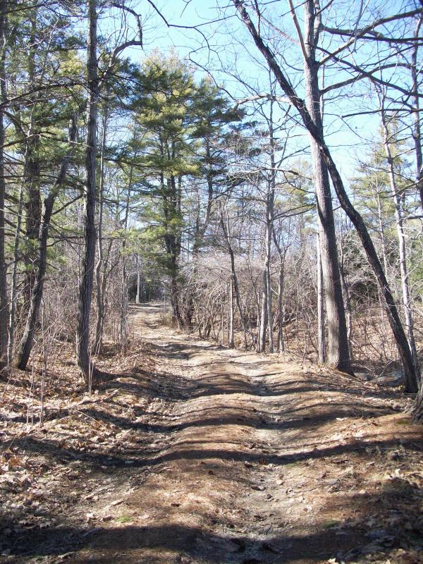
Here in Wiscasset, we’re fortunate to have several first rate nature trails to enjoy, all within a five-minute drive of downtown. One of the more interesting is Cushman Mountain Preserve, owned and maintained by Chewonki Foundation. Hiking it carries you high over Cushman Cove and the Back River, offering a fine view from its summit.
The trail’s northern entrance is a few miles south of the Wiscasset Municipal Building. Driving from that direction, turn left onto the Birch Point Road (Route 144) and follow the road until you come to a sharp turn. Bear left there and onto a short side road that once served as the entrance to the former Central Maine Power-owned Mason Station. You’ll have to park your vehicle on the side of the road because there’s no parking area.
The trail begins on a small gravel road that runs gradually downhill and roughly eastwards towards the river. You’ll pass a small inlet on the left called Boom Cove, so named because raw timber was once stored here in log booms for a nearby lumber mill that operated in the late 19th century.
Later this same cove served as an ice pond where ice was sawed by hand into huge blocks and then sold commercially to markets as far south as New Orleans. Today, mallards, black ducks and cranes can often be seen enjoying the cove’s calm waters.
Just past the saltmarsh the trail begins running uphill and soon divides. Here you’ll see a small stone monument to the late Margaret Stetson of Wiscasset who donated this property to the Chewonki Foundation in 1999. Chewonki subsequently acquired the adjacent 29-acre Cushman meadow. It was from Stetson’s uncle, Erastus Foote Jr., that the high ridge that overlooks the river got its earlier name, Foote’s Mountain.
Following the left path takes you to Birch Point and the site of a former dam. The trail carries you past a mucky weep spring where the ground is spongy year-round. After crossing a small gully you’ll come to a large meadow. Not too many years ago this entire area was all cleared pastureland.
Crossing the meadow, bear right through a small stand of birch trees that eventually opens and offers you a nice view of the river and the former Mason Station. It’s from here that you’ll see what remains of the former wooden and earthen dam that once spanned the mouth of Boom Cove. Pilings on the opposite shore mark the remains of the Sturges Lumber Mill where in the late 19th century timber was sawed into planking.
To get to the summit of Cushman Hill, also known as Foote’s Mountain, return to the fork in the road by the stone memorial and follow the road as it winds its way eastward. For a short distance it runs beside a brook as it gradually rises. You’ll see an old stone impoundment where the brook was once dammed for a holding pond.
The road ends at a series of crisscrossing trails left behind by a skidder during what was a fairly recent logging operation. Be advised, from this point the trail is unmarked and so it’s a good idea to carry along a compass or GPS devise. To reach the summit bear right, this will carry you up a steeper grade that leads to a series of still higher hills that in Colonial times were known as “Bakers Mounts.”
If you stay on the beaten path overlooking the river you’ll come to four rather sizable cement blocks in the middle of the trail. These cement blocks once served as the footings for an observation tower. In the early 1900s, Erastus Foote Jr. had a lookout tower erected here. From its top he could enjoy a bird’s eye view of his property and the surrounding area. After Foote died the tower went unrepaired and was eventually taken down in the late 1930s or 1940s. Today towering northern pines trees surround the site.
It’s important to keep your bearing along the way. The path you want runs roughly south/south west and parallel to the river. The main trail splits in several places, the easiest way is to bear left. Somewhere close to the summit is a benchmark left by a U.S. Geological Survey team. (Neither I, or Dean Shea of Wiscasset who accompanied me on this hike were able to find it; although it’s shown on the topographical map.)
The trail eventually dips downwards and brings you out at the other end of Route 144 just short of the Westport Bridge. This path overlooking the river is roughly a mile or so and is still referred to as the Old Indian Trail. According to the legend the Wawenocks made a seasonal pilgrimage to hunt, fish and drink from a spring not far from the inlet said to have magical and curative powers. The woods here still abound with white tail deer, fox, raccoon, wild turkey and bobcat. Maybe the animals, too, come to drink from the fabled enchanted waters. The morning of our hike we saw evidence of both deer and moose at the higher elevations.
The 117-acre Cushman Preserve is open year-round offering both enjoyable hiking and snowshoeing. No motorized vehicles of any kind are permitted. Whatever you carry in, you should carry out. You can download a trail map by visiting www.wiscasset.org and clicking on “Community Trails” under the “Visit” tab.