King Phillips Trail
 Robert Mitchell photo
Robert Mitchell photo
Robert Mitchell photo
It's kind of a neat loop over there in East Boothbay. Little River. Woods roads. Some cabins and a refreshing water side stroll if you are so inclined. Another favorite of mine when wandering around the region enjoying our beautiful location on the planet.
King Phillips Trail sounds very official. I don’t know the history of that name. Sounds pretty dignified. But I have always enjoyed my visits there, especially the east side of the point along the Damariscotta River. During heavy running seas the shoreline can be quite active, especially in a southeasterly or strong easterly storm when the surf gets pushed up against and sometimes over the road, not unlike what happens at Ocean Point when the storm is just so.
My earliest visits to that stretch of road came when I first landed here at Treasure Island. I used to jog around the loop. And, during a small gathering at Treasure Island, I met and was invited by Dr. Bob and Marian Glaesner, to stop by their little cottage which faced east along the river. The Glaesners were friends of the Washingtons who owned Treasure Island then. They were a lot of fun to hang out with during their summer visits to Maine. Dr. Bob was a dentist from Michigan who sometimes popped in at Dr. Greene’s practice in the Harbor. I was happy to make their acquaintance and would often bump into them around town. Visits to their cottage were frequent and enjoyable. Visits to the dentist were, well, less enjoyable but Mary Pinkham fixed that!
In later years after my arrival, I regularly photographed with and for Harry and Jonelle Edelson and family at their summer place on what I used to know as “Ocean Island” or “Indian Island.” I never quite figured out which was correct. Back in the day, when I believe the Tharpe family owned the property, it was an area hotspot with music and such. I think I recall Jimmy Tharpe playing piano there. I’m not sure who owns the property now but it is a grand location with Little River on one side, the mouth of the Damariscotta River and open ocean on the other. It’s a dandy spot to watch big waves crashing up against significant outcroppings.
Today’s photo is a bit upriver from “Ocean Island,” with South Bristol in the rear-view mirror. Just beyond the point from the photo, King Phillips trail climbs a bit just enough to see out over Inner Heron and on to Pemaquid Point. Many years ago, I managed a photo of a super moon coming up out of the sea from that location. That was a bit before super moon photos became a dime a dozen with big, sophisticated lenses and cameras, neither of which I have managed to acquire.
Truth be told, you don’t need a photo tool to appreciate this splendid stretch of waterfront. It is a beautiful drive or walk available to all. Have a look sometime.
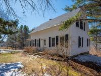
P.S., and, if you can’t link the photo and text, it’s because the photo was made from the southern end of Pratts Island, not King Phillips Trail. I wrote about a photograph I had not made! Sorry.
Maybe next week I will correct this. Maybe not! Have a good day.