Storm’s coming, Central Maine Power prepares
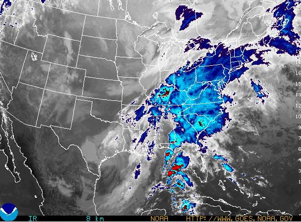
While rain — possibly two to three inches of it — and warmer temperatures are in the Midcoast forecast, winds are going to pick up and gust out of the south tonight and Wednesday. By the time this late fall storm blows out and Thanksgiving is here, temperatures are going to drop dramatically and winds, still strong, will shift around to the west.
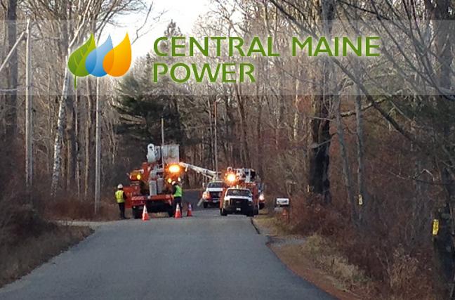
Central Maine Power is preparing for the heavy weather, coordinating its storm preparation efforts with other utilities in the North East Mutual Aid Group. It is also lining up contract crews to assist local crews if the storm causes widespread damage, CMP said.
If your power goes out, call 800-696-1000. To see more information on storm safety and restoration, including a town-by-town listing of outages in the CMP service area with an area map, visit cmpco.com.
“Utility trucks are fueled and equipped, and key CMP personnel are holding periodic pre-storm planning sessions to discuss staffing levels and finalize storm-response plans,” said Gail Rice, spokesperson for Central Maine Power, in a news release. “High winds are always a concern, and the heavy rains forecast for Wednesday could saturate the ground around trees. We expect high winds and tough working conditions, so we’re getting crews, equipment, and materials in place to respond.”
The storm will present as rain on the coast tonight, mainly after 10 p.m. Temperatures are going to rise into the upper 40s and 50s, and southerly winds are to increase, 25 to 30 miles per hour, with gusts up to 40 mph. If you are heading Downeast, take care for winds are expected to blow harder there, gusting up to 60 mph, especially on the water and outer islands. NOAA maintains a system of weather buoys on the water. Visit their buoy page to get a read on what’s happening with conditions at sea.
By Thanksgiving Day, clouds will clear and the wind will shift around to the west, but will remain gusty, up to 30 mph. Then, by Friday night, low temperatures, around 14 degrees, will settle in.
CMP cautions avoiding downed wires.
“These lines should be considered live and dangerous,” CMP said. “Customers should leave the clean-up to our crews, who are trained and equipped to handle these situations safely.”
The utility company also reminds drivers to give utility crews a wide berth.
“Working conditions are difficult, and the workers appreciate everyone’s consideration for their safety,” the company said.
The Maine Emergency Management Agency is cautioning drivers to avoid flooded roads.
“Remember, ‘turn around, don’t drown,’” the agency advises.
The power of water is strong: six inches of fast-moving flood water can knock over an adult, and it takes but two feet of rushing water to carry away vehicles, MEMA said.
If you want to get into the thick of it and learn the latest weather warnings, sign up for text or email warnings from the National Weather Service at MEMA.
Home preparations
Besides preparing Thanksgiving dinner, there are storm preparations to keep in mind, such as getting battery-operated flashlights and radios on hand, along with supplies of drinking water and non-perishable foods. CMP also advises:
When using an emergency heating source, like a wood stove, fireplace, or kerosene heater, keep fuels away from the flames and be sure to ventilate properly.
Never use grills or camp stoves indoors. They can give off dangerous gases.
Don't run a generator indoors, even in an open garage, and hire a licensed electrician to install permanent generators and transfer switches.
Make sure portable generators are properly grounded. Don't store fuel indoors or try to refuel a generator while it's running.
On the road?
If you plan to travel to the mountains and want to know road conditions, call 511 or visit http://511maine.gov. Driving in winter conditions can be nerve-wracking and perilous. Some tips from the Maine Department of Transportation:
Drive slowly – below posted speed limits – to adjust to the conditions. This is especially true at intersections, off ramps, bridges and shady areas where black ice can form without being noticed.
Four-wheel drive may help you get going faster but it doesn't help you stop sooner or maintain control better once you loose traction.
Don't tailgate. Longer stopping distances and extra time are required during winter conditions to avoid chain reaction crashes.
Take no chances when pulling out in front of approaching vehicles. When pavement is wet, slowing down and accelerating is not the same as on dry pavement.
Avoid using cruise control. Don't let your cruise control make a bad decision for you.
Avoid any sudden or excessive actions while steering, braking or accelerating so you don't loose control.
Brake early, brake slowly, never slam on the brakes. If you have anti-lock brakes, press the pedal down firmly and hold it. Gently pump the pedal if the brakes are not anti-lock.
Beware of what's going on well ahead of you. Other vehicles can alert you to problem spots on the road which may give you the split second you need to avoid a crash. Stay off the phone.
Speaking of phones
Storms can knock out power and communications can be stalled, damaged or become congested. Some more tips from MEMA, crafted especially for disasters.
- Maintain a list of emergency phone numbers in your cell phone and in or near the home phone.
- Keep charged batteries and car-phone chargers available for back-up power for the cell phone.
- If you have a traditional landline (non-broadband or VOIP) phone, keep at least one non-cordless phone in your home because if it will work even if power is lost..
- Prepare a family contact sheet. This should include at least one out-of-town contact that may be better able to reach family members in an emergency.
- Program “In Case of Emergency” (ICE) contacts into your cell phone so emergency personnel can contact those people for you if you are unable to use your phone. Let your ICE contacts know that they are programmed into your phone and inform them of any medical issues or other special needs you may have.
- If you are evacuated and have call-forwarding on your home phone, forward your home phone number to your cell phone number.
- If you do not have a cell phone, keep a prepaid phone card to use if needed during or after a disaster.
- Have a battery-powered radio or television available (with spare batteries).
- If you don’t know how to text on your cell phone, learn. Text messages can often get through when voice cell phone systems are jammed.
- Subscribe to text alert services from local or state government to receive alerts in the event of a disaster.
If you have a life-threatening emergency, call 9-1-1. You cannot currently text 9-1-1. If you are not experiencing an emergency, do not call 9-1-1.
If you are in need of information such as location of emergency shelters, other services, or safety information, dial 2-1-1 (toll-free in Maine, 1-866-811-5695 if you are out of state) or visit 211maine.org
For non-emergency communications, use text messaging, e-mail, or social media instead of making voice calls on the cell phone to avoid tying up voice networks. Data-based services like texts and emails are less likely to experience network congestion. Use social media to post status to let family and friends know you are okay. In addition to Facebook and Twitter, use resources such as the American Red Cross’s Safe and Well program.
Keep phone calls brief. If you need to use a phone, try to convey only vital information to emergency personnel and/or family.
If you are unsuccessful in completing a call using your cell phone, wait 10 seconds before redialing to help reduce network congestion.
Conserve cell phone battery by reducing the brightness of the screen, placing phone in airplane mode, and closing apps, which draw power.
The forecast, courtesy of NOAA
For Rockport
- Partly sunny, with a high near 40. Southwest wind 5 to 10 mph.
- Tonight Rain, mainly after 10pm. Temperature rising to around 44 by 5am. Southwest wind 5 to 15 mph becoming southeast after midnight. Chance of precipitation is 100%. New precipitation amounts between a quarter and half of an inch possible.
- Wednesday Rain. The rain could be heavy at times. High near 57. Windy, with a south wind 25 to 35 mph, with gusts as high as 45 mph. Chance of precipitation is 100%. New precipitation amounts between three quarters and one inch possible.
- Wednesday Night Rain before 4am, then a chance of rain, snow, and sleet. Low around 30. Windy, with a south wind 20 to 30 mph becoming west after midnight. Winds could gust as high as 45 mph. Chance of precipitation is 90%.
- Thanksgiving Day Partly sunny, with a high near 32. Breezy, with a west wind 20 to 25 mph.
- Thursday Night Partly cloudy, with a low around 13.
- Friday Sunny, with a high near 27.
- Friday Night Mostly clear, with a low around 16.
- Saturday Sunny, with a high near 30.
- Saturday Night Partly cloudy, with a low around 22.
- Sunday A chance of rain and snow showers. Mostly cloudy, with a high near 40. Chance of precipitation is 30%.
- Sunday Night A chance of rain and snow showers. Mostly cloudy, with a low around 33. Chance of precipitation is 40%.
- Monday A chance of rain showers. Mostly cloudy, with a high near 44. Chance of precipitation is 30%.
Reach Editorial Director Lynda Clancy at lyndaclancy@penbaypilot.com; 207-706-6657/
Event Date
Address
United States

